
 News4JAX
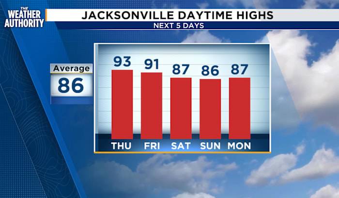
Near record highs continue through Friday with an increasing chance of showers and storms as a cold front slides south through Saturday. The onshore wind returns Sunday through the start of the week.
Thursday: Patchy to dense morning fog then partly cloudy to mostly cloudy skies. Showers and isolated thunderstorms will be possible as the sea breeze moves inland, 20-30 percent. Morning lows in the 60s to 70s. Afternoon highs in the 80s to low 90s. Feels Like temperatures around 99 - 105 degrees. Patchy to dense fog overnight.
Looking ahead: Increasing rain chances Friday and Saturday with partly cloudy skies and less shower activity on Sunday.
Tropics: Tropical Storm Gabrielle is a Category 2. Invest 93 became Tropical Storm Humberto at 5 p.m., while Invest 94 continues to be closely mon

 Breitbart News
 Raw Story
 US Magazine Entertainment
 Bozeman Daily Chronicle Sports