
 Click2Houston
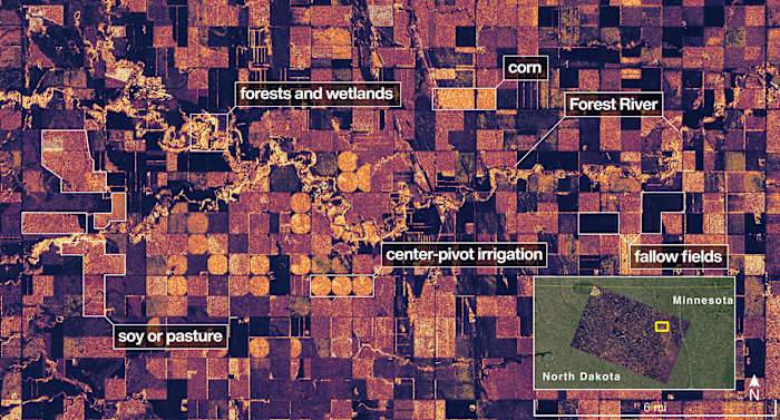
1 / 2
This image provided by NASA/JPL-Caltech on Aug. 23, 2025, NISAR imaged land adjacent to northeastern North Dakotas Forest River, light-colored wetlands and forests line the rivers banks, while circular and rectangular plots throughout the image appear in shades that indicate the land may be pasture or cropland with corn or soy. (NASA/JPL-Caltech via AP)
CAPE CANAVERAL, Fla. – NASA's first radar images from a new Earth-mapping satellite show the Maine coast and Minnesota farmland in incredible detail.
The pictures, released Thursday, are from a spacecraft that rocketed into orbit from India two months ago.
The joint U.S.-Indian mission, worth $1.3 billion, will survey virtually all of the world’s land and ice masses multiple times. By tracking even the slightest shifts in lan

 LiveNOW from FOX Crime
 SpaceNews
 The Motley Fool
 AlterNet
 Associated Press US News
 Slate Politics
 The Hill