
NASA and ISRO have released the first radar images captured by their joint Earth-observing satellite, NISAR (NASA-ISRO Synthetic Aperture Radar). Launched on July 30, 2025, the satellite carries advanced L-band and S-band radar systems, designed to provide unprecedented insight into Earth’s dynamic surface. The initial images, captured in August, reveal remarkable detail, from dense forests and wetlands to farmland patterns and urban areas, highlighting the potential for monitoring ecosystems, agriculture, and natural disasters. NISAR’s success represents a milestone in international collaboration, combining NASA and ISRO expertise to advance science, technology, and global understanding of Earth’s changing environment. The NISAR satellite is the first to carry both L-band and S-ba
NASA-ISRO's NISAR sends first radar images of Earth's surface; reveals exceptional details of land, forests and agriculture
 The Times of India6 hrs ago
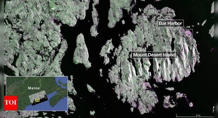
100

 News9
News9 Odisha Bytes News
 The Cut
 OK Magazine
 IMDb TV
 Reuters US Politics
 The Oregonian Public Safety
 The Babylon Bee
 RadarOnline
 Vogue Beauty
 AlterNet
 The Daily Beast