
 News9
News9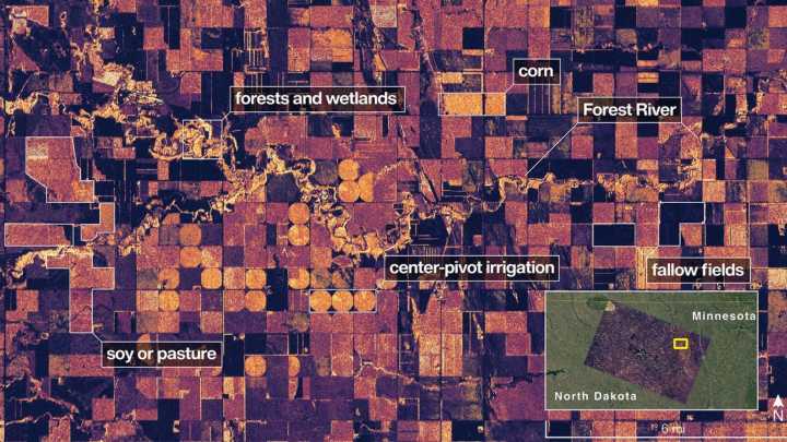
New Delhi: The NASA-ISRO Synthetic Aperture Radar (NISAR) satellite has relayed back preliminary images of the planets surface, providing scientists with an idea of the capabilities of the most powerful radar satellite for Earth observation ever deployed. The images reveal the level of detail with which the satellite can monitor the Earth, providing decision-makers with actionable insights in disaster response, infrastructure monitoring and agriculture management. One of the released images is of the region adjacent to the Forest River in North Dakota, where a the water is winding through agricultural land. Another image is of the Mount Desert Island in Maine, with the magenta indicating bare surfaces and the green indicating forest cover.
Mount Desert Island in Maine. (Image Credit: NAS

 The Times of India
 Odisha Bytes News
 The Washington Post Opinions
 RadarOnline