
 NBC10 Boston
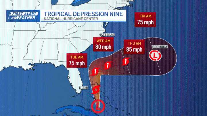
The rain moved on early and the clouds departed Sunday afternoon. Highs soared into the 80s with a gusty west, southwest wind and full sun. A few clouds move through again after sunset, and that will turn our wind direction ushering in some lowering dewpoints.
That stationary boundary to our south, and a strong high pressure system heading in from the northwest, will play a crucial role in keeping away any tropical systems making landfall in the northeast. Our local forecast remains warm through Tuesday, with a significant cool down for midweek.
Stream NBC10 Boston news for free, 24/7, wherever you are. WATCH HERE
Our waves offshore increase as Humberto passes by but is deflected out to sea midweek. Wednesday and Thursday waves will be 5-10 feet offshore so watch for dangerous rip

 Associated Press Top News
 CNN Climate
 Arizona's Family
 KWWL
KWWL The Weather Channel
 TMJ4 News
 WWSB
WWSB WFMJ-TV Sports