
 WWSB
WWSB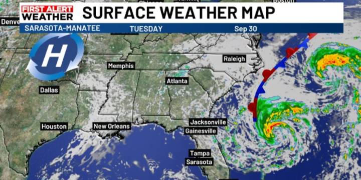
SARASOTA, Fla. (WWSB) - Tropical Storm Imelda is moving away from the Bahamas, and as it pulls east, it’s drawing in drier air over our region. This has already been detected in the middle and upper levels of the atmosphere, which means rain chances will stay low through Wednesday. A few showers may drift in from the northeast, but most of these will fade before reaching the coast.
By Thursday and Friday, an upper-level trough and a surface boundary will move in, bringing more moisture with them. This will increase rain chances and also cause winds to pick up from the east and northeast as the pressure gradient strengthens. The unsettled weather pattern is expected to stick around through the weekend, keeping conditions a bit breezier and wetter than the first half of the week.

 WBTV Mecklenburg County
 News4JAX
 ClickOrlando
 FOX 51 Gainesville Crime
 KCRA News
 FOX 35 Orlando
 Ocala Star-Banner
 Associated Press US News
 NBC 6 South Florida
 Law & Crime
 First Coast Crime
 Lake & Sumter Style Magazine
 AlterNet