
 News4JAX
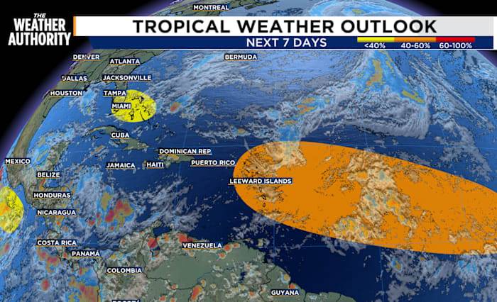
We continue to monitor two areas in the Atlantic. One area will bring weekend rain and the other could become our next tropical trouble spot.
The area of low pressure located near the central and northwestern Bahamas is producing disorganized shower activity.
This system is expected to drift west-northwestward across the northwestern Bahamas and toward southern Florida during the next couple of days.
Strong upper-level winds are expected to prevent significant development of the low, however the combination of the disturbance and the broader remnant boundary is still expected to produce heavy rainfall and possible flooding across portions of Florida through the weekend.
The formation chance through 48 hours and 7 days remains at 10 percent.
Deeper in the Atlantic, a tropical wave has

 Associated Press US and World News Video
 LiveNOW from FOX News
 Gainesville Sun
 Space.com
 Eyewitness News 3
 Fox 26 Liberty County
 FOX 32 Chicago
 NBC Connecticut
 Raw Story