
HASTINGS, Neb. (KSNB) - Good Saturday evening! After we saw scattered showers and weak storms early this morning, another chance of showers and isolated thunderstorms will come tonight into early Sunday morning. Chances will be best over Western and Northern Nebraska with lower chances the farther southeast that you go. Clouds will thin out on Sunday allowing for more sunshine ahead of an approaching cold front. That front will be pushing through the western half of the area Sunday morning. Out ahead of it, expect strong southerly winds. Some gusts could again be up to around 35 mph. As the front passes through in the late afternoon, winds will turn northwesterly. But won’t be as strong as ahead of the front. Sunday morning starts off very mild with lows from the lower 50s on the eastern e
A warm and windy start to the new week ahead of cool and unsettled weather Monday and Tuesday
 KSNB Local4 Central Nebraska2 hrs ago
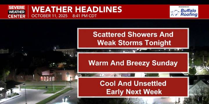
24

 America News
 Santa Maria Times Local
 WITN-TV
 Newsday
 KSLA News
 Denver7 News
 MassLive
 Raw Story
 Atlanta Black Star Entertainment