
 Hawaii News Now
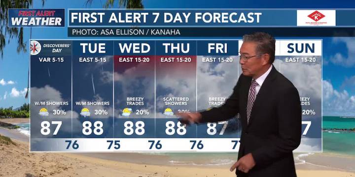
HONOLULU (HawaiiNewsNow) - Light southeast surface winds continue through Tuesday, with stronger trades kicking in Wednesday into lasting into next weekend.
Windward and mauka showers will pick up through Tuesday.
A storm several hundred miles north of the state will continue to move south through midweek, then weaken and slide off to the west. This will bring a chance for heavier showers and a few thunderstorms from Wednesday into Friday evening.
HIGH SURF ADVISORY is on for most north and west shores through Tuesday.
The NW swell peaks Tuesday with dangerous wave heights.
Minor south pulses are expected through the week.
East shores will pick up when the winds strengthen on Wednesday.

 WBRC
WBRC 21Alive News
 Associated Press US News
 ClickOrlando
 KOLD Tucson
 CBS News
 Associated Press US and World News Video
 The Fashion Spot
 AlterNet