
 WKYT
WKYT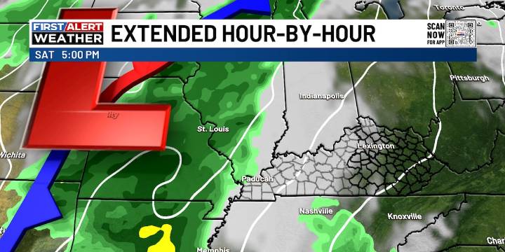
LEXINGTON, Ky. (WKYT) - It’s another fantastic fall day across the Commonwealth, but change is brewing on the horizon. Those breezy winds you feel are a sign of what’s to come: a strong fall storm system is gearing up to move in this weekend, kicking off a much more active stretch for the back half of October.
A weak front slides through today, trimming temperatures a bit for central and eastern Kentucky on Thursday and into part of Friday. After that brief cooldown, all eyes turn to the weekend setup.
Here’s how things look to unfold:
A low-pressure system pushes out of the Rockies and into the Plains Friday into Saturday, dragging a cold front closer to Kentucky.
As that front approaches, another wave of low pressure will form along it, helping to fuel showers and storms.
Rain and t

 WBKO
WBKO Breitbart News
 Mediaite
 CBS News
 Honolulu Star-Advertiser Traffic
 IMDb TV
 Bitcoin Magazine