
 WITN-TV
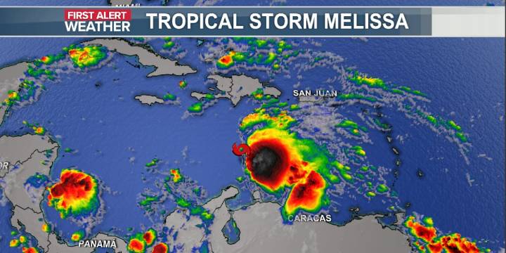
A developing low in the central Caribbean Sea now has a well-defined center and is already producing winds up to 50 mph. The National Hurricane Center’s first advisory and forecast track (“the cone”) on Melissa is expected around 11:00 AM EDT.
The future track of this system is still in question later this week. As it slows down, it may start to drift northward towards Cuba and Haiti. Areas in the Caribbean and even South Florida should watch this system closely. Upper air pattern stays active for the Carolinas, increasing the chance of this system being pushed back out into the Atlantic if it gets far enough north to be a threat.
Hurricane season continues to wind down. Right now, nothing looks to develop and impact the Carolinas in the short term. Late-season storms typically develop

 ABC News
 Raw Story
 CBS News