
 WMTV NBC15
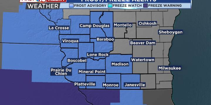
Light rain and drizzle taper off this evening over eastern Wisconsin.
Frosty conditions develop the next few nights.
Sunshine into this weekend!
MADISON, Wis. (WMTV) - An upper low over Lake Huron continues to generate light drizzle and showers over east-central and southeastern Wisconsin, expected to fade by early evening as high pressure builds from the Dakotas. Clearing skies and weakening winds west of Madison will promote frost formation late tonight, with temperatures dipping to freezing in some areas. A Frost Advisory is active west of the Sauk–Dane–Rock County line, and sensitive plants should be protected. By Thursday night, the high settles overhead, bringing the coldest night of the season so far, with widespread freezing temperatures and likely Freeze Warnings. Click Here

 KELO
KELO WSIL-TV
 America News
 KPTV Fox 12 Oregon
 KGET 17 News
 FOX 32 Chicago
 ESPN Video
 DoYouRemember?