
 WLFI News 18
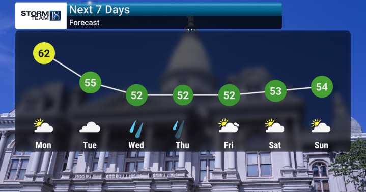
We've got periodic chances for rain lingering through next weekend, so it's definitely something we will be monitoring. Looking ahead to Tuesday night into Wednesday we're tracking a potential system that could bring gusty winds and moderate rainfall to parts of our area. While the heaviest precipitation appears most likely south of I-70, we'll be watching for the potential of more widespread impacts.
Temperatures are expected to be running near to slightly below seasonal norms for this time of year. This means we won't be seeing any unusually warm spells. Instead, expect cooler days and nights as we progress through the extended forecast.
After seeing highs in the low 60s Sunday, we climb into the mid 60s Monday. By Tuesday, cloud cover increases with a highs in the upper 50s. The real

 Local News in Arizona
 Associated Press US and World News Video
 The Oregonian Public Safety
 Daily Voice
 FOX 13 Tampa Bay Crime
 WCBI-TV
 Associated Press Top News
 The Seattle Times
 The Washington Post Opinions
 HealthDay