
 WRCB-TV
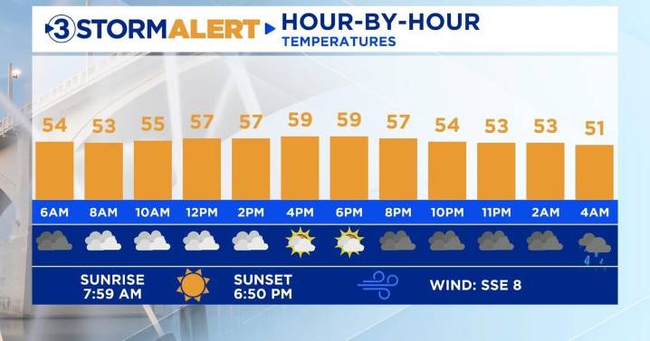
Good morning! We are dealing with pockets of fog and drizzle this morning that could lead to some slowdowns on our morning commute. Conditions will gradually improve later today, but the chances of seeing any sunshine are pretty low. Temperatures will hover in the 50s for much of the day as cool air wedges in from the east.
Our next round of widespread rain returns on Wednesday morning as a cold front sweeps across the Tennessee Valley. Heavy rain will break out between 3-5 AM and continue through the evening. Gusty winds of 25-35 mph are possible as the front moves through. Up to 1” of additional rainfall is expected with this system, putting a dent in our October drought. Highs on Wednesday will range from the upper 40s to the lower 50s.
Light rain gradually tapers off Thursday morning

 WAND TV
 FOX 13 Tampa Bay Crime
 Reuters US Top
 WWSB
WWSB IMDb TV
 NBC News
 The Hill