
 WDHN News
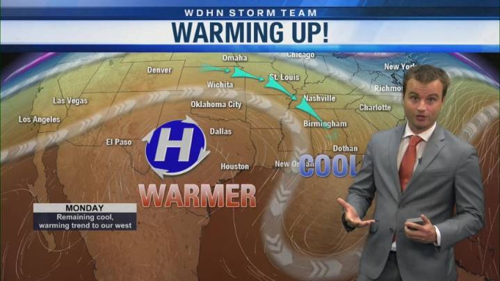
DOTHAN, Ala. (WDHN) — Monday morning got off to a chilly start across The Wiregrass, but this pattern is not here to stay for long.
Temperatures started off in the upper 30s for most of us, thanks to a front that moved through Sunday and high pressure sitting overhead. This gave us relatively light winds and clear skies, allowing temperatures to dip.
By Monday afternoon, we will quickly warm into the mid to upper 60s. Skies will remain sunny as breezes remain relatively light.
As we go throughout the week, we will see a gradual warmup each day.
This will happen as an upper-level high pressure system builds in from west to east, boosting our highs back into the 70s by Tuesday and into the 80s by Thursday.
At the same time, lows will rebound to the 40s by Tuesday, 50s by Thursday, and 6

 WBRC
WBRC WVTM 13
 KCTV5 News Kansas Sports
 Raw Story
 The Daily Beast
 TMZ
TMZ