
 WSMV 4 Nashville
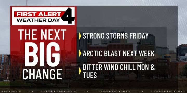
NASHVILLE, Tenn. (WSMV) - Big weather changes are coming late this week and into next week
A First Alert Weather Day has been issued for Friday due to the threat of strong to severe thunderstorms across Middle Tennessee and Southern Kentucky. A strong cold front will approach the Midstate late in the afternoon and fire off scattered thunderstorms through the evening.
The severe threat is a level 2/5 on the scale for much of the Midstate, with the main storm threats being heavy rain and gusty winds.
A First Alert Weather Day is also in effect for Monday and Tuesday morning for the first freeze of the season in the second week of November.
Nashville’s expected start temperature will be 32 degrees.
Here are instructions on how to watch WSMV4 live on various platforms.
The high w

 WVLT
WVLT WBRC
WBRC Action News 5 Crime
 Newsweek Top
 AlterNet
 OK Magazine
 Associated Press US News
 Desert Sun Life
 AmoMama