
 WEVV 44News
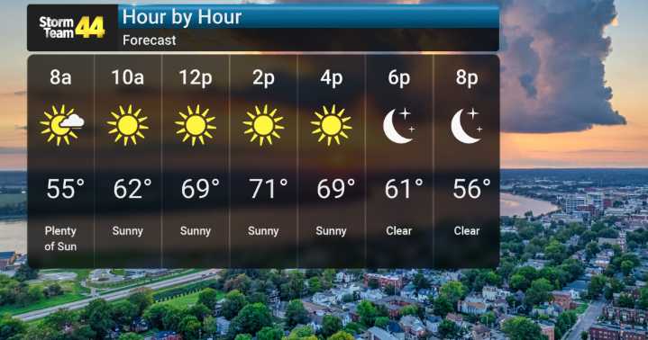
Today and Thursday are looking picture-perfect, with abundant sunshine and temperatures feeling just right for this time of year. We're expecting highs in the upper 60s to lower 70s today, with the warmth continuing into Thursday as it remains dry.
However, as we head toward Friday, we'll need to be on alert. A cold front is set to move through, and this will bring a chance for showers and thunderstorms to our area.
Behind Friday's system, things will dry out for Saturday with a mix of clouds and sun, and temperatures holding steady. Significantly cooler-than-normal temperatures will push in, bringing us the coldest air we've seen so far this year. Sunday night and Monday night, we're expecting lows to drop into the 20s, meaning we'll likely see our first freeze of the season.

 Western Slope Now
 abc27 News
 FOX 26 Texas
 The Weather Channel
 Deseret News
 WSMV 4 Nashville
 K2 Radio Local
 WSAZ NewsChannel 3
 Watertown Public Opinion
 WKOW 27
 KXLY 4 News
 AlterNet