
 WEVV 44News
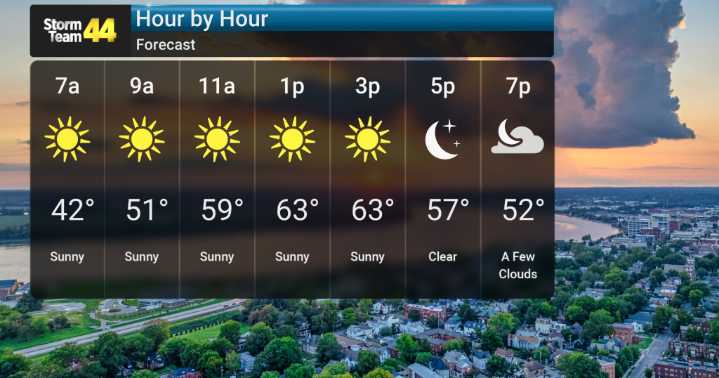
Today, we're enjoying a very pleasant day with sunshine and highs in the comfortable 60s. However, things are set to change as we head into Friday. Later this week, a cold front is expected to arrive, bringing with it a chance for showers and even a few thunderstorms.
Another disturbance could bring us a chance for more rain, particularly Saturday evening into early Sunday morning. Then, a brief, but definitely bitter, Arctic blast will bring what are shaping up to be the coldest temperatures of the season by far, especially for Sunday and Monday.
High temperatures on Monday may struggle to climb above 40 degrees in many spots around Southern Indiana. And it's not just the air temperature; we're forecasting wind chills between 10 to 20 degrees Fahrenheit Monday morning.

 FOX 26 Texas
 The Weather Channel
 Deseret News
 WSMV 4 Nashville
 K2 Radio Local
 WSAZ NewsChannel 3
 Watertown Public Opinion
 WKOW 27
 KXLY 4 News
 Aljazeera US & Canada