
 WAAY TV
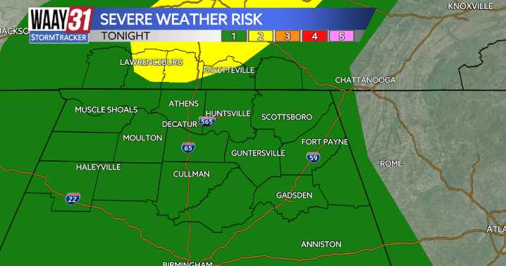
** LOW END SEVERE WEATHER RISK IN PLACE TODAY **
Multiple cold fronts are set to push through the Tennessee Valley this weekend, the first one arriving today. With it comes a limited risk of strong to severe storms this evening.
Waking up this morning, temperatures are sitting in the mid to upper 50s, with highs reaching the low 70s by the afternoon. A few isolated showers are possible this afternoon, but as we head into the evening hours, a broken line of storms is expected ahead of the cold front. The main threats will be damaging winds and hail. The tornado risk is very low—but never zero.
Partly cloudy skies with highs in the low 70s are expected Saturday, as we’ll be between cold fronts. A shower or two is possible Saturday evening, but most areas should stay dry.
Sunday marks the

 FOX 26 Texas
 The Weather Channel
 Florida Today
 Deseret News
 WSMV 4 Nashville
 WMAR-2 News
 WKOW 27
 Watertown Public Opinion
 Fox 11 Los Angeles Sports
 WIS News 10
 AlterNet