
 News Channel 36
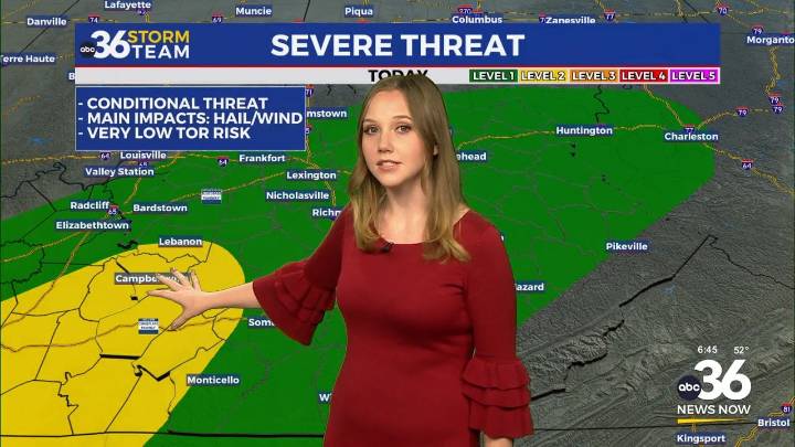
Today – Tonight
Temperatures this morning are in the 40s and 50s with high temps in the 60s. Winds are already gusting up to 20 mph. These will ramp up even more as we head through the day, gusting up to 30-35 mph later Friday afternoon. A line of showers and storms will move through this afternoon, starting with some scattered sprinkles to the NW. As the cold front moves SE, it will form into a line of storms. We may see a chance for some stronger storms, mainly S of I-64 and W of I-75. This is where we see a Level 2 severe risk. The most likely scenario is a few stronger storms with some hail and gusty winds, and most just see a soaking rain.
However, a few isolated storms may be able to strengthen and become severe. These storms may see some larger hailstones, winds 58+ mph, and a ver

 FOX 26 Texas
 WCNC Charlotte Weather
 WTVM News Leader 9
 The Weather Channel
 Petoskey News-Review
 Florida Today
 Deseret News
 WMAR-2 News
 WSMV 4 Nashville
 Detroit Free Press