
 WAND TV
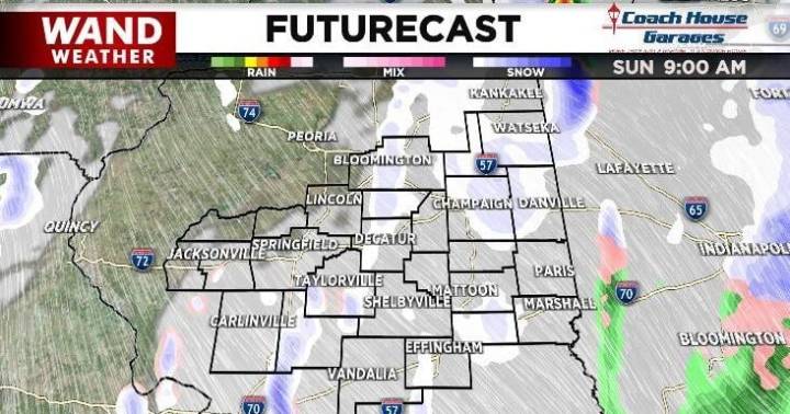
Saturday morning started off a bit cooler than Friday did which signals a pattern shift coming our way this weekend. The map below shows temperatures were about 20º colder across our area Saturday morning than they were Friday morning.
That cold air continues to flow into our region this weekend and means that what starts as light rain Saturday afternoon will transition to snow showers by Sunday morning. Those snow showers will continue off and on through Sunday, enhanced by northerly flow off Lake Michigan.
We won't talk about accumulation in this post because the ground is too warm for the snow to stick and stack up. You will see snowflakes flying in the air and may even get some to stick to your deck or car, but it won't accumulate.
What you don't see in these maps is that the wind w

 Talk 95.3 MNC
 WKYT
WKYT WMTV NBC15
 WEIS Radio
 KPTV Fox 12 Oregon
 Orlando Sentinel
 WCNC Charlotte Weather
 The Columbian
 NewsChannel 5 Nashville
 KSAT 12