
 ABC57 News
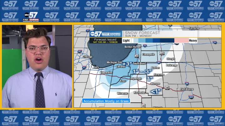
To view this video please enable JavaScript, and consider upgrading to a web browser that supports HTML5 video
The weekend starts on a dreary note, with widespread clouds before a wintery mix. Most of our area stays dry through the daytime, some sprinkles expected to pick up a little closer to sunset. Rain expected through the overnight hours, at some point in time flipping to system mixed precipitation/snow into Sunday morning. None of the snow is expected to stick from this first round, but it will help cool down the ground. Sunday starts on the drier and gustier side, but more precipitation chances expected in the afternoon, with a Lake Effect system impacting portions of Michiana. Lake Effect snow continues into Monday morning with St. Joseph, Marshall, LaPorte, and Starke County Ind

 WATE 6 On Your Side
 CBS 58 News
 LEX 18 News
 Times Herald-Record
 WCNC Charlotte Weather
 WNNY-TV
 The Columbian
 Talk 95.3 MNC
 WKYT
WKYT WAND TV
 KPTV Fox 12 Oregon
 NewsChannel 5 Nashville
 America News