
 ClickOrlando
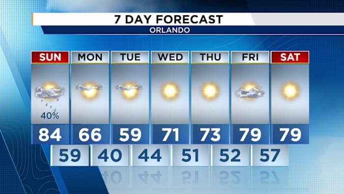
ORLANDO, Fla. – Today was a warm one! High’s managed to climb back into the upper 80s for a lot of us across the state of Florida. Sunday looks to be a repeat of this, with a stormy twist. The SPC has us tagged for an isolated threat for severe weather, primarily in the form of damaging winds. The possibility of some small hail in our more organized thunderstorms can't be ruled out all thanks to the rapid chill that's going to be coming in from up north. (Copyright WKMG 2025)
Storm Prediction Center has the entirety of our viewing area highlighted for a level one, marginal risk of severe thunderstorms. The primary risk we’re pinpointing is damaging straight-line winds, followed up by the low potential for small hail. The storm system has started digging south tonight, headed our way

 CBS News Crime
 Orlando Sentinel
 WCTV
WCTV New York Post
 Mediaite
 Star Beacon
 WWSB
WWSB AlterNet
 CNN
CNN