By Joe Lombardi From Daily Voice
A powerful Arctic cold front is sweeping across the Northeast, bringing the first measurable snowfall of the season to parts of the Northeast.
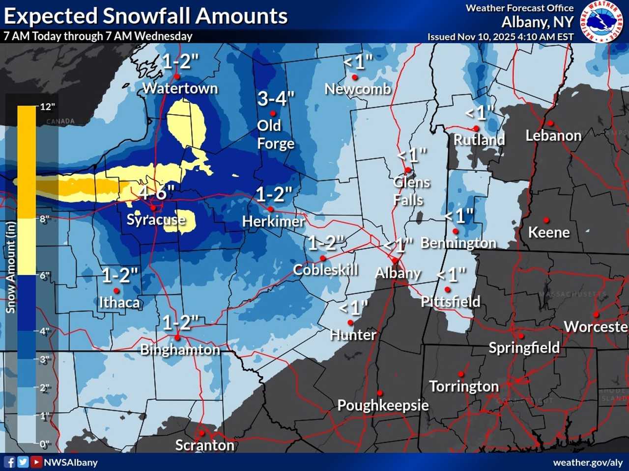
The National Weather Service reports that areas in the southern Adirondacks and western Mohawk Valley could see 2 to 4 inches of lake-effect snow through Tuesday morning, Nov. 11.
Parts of upstate New York and northern Pennsylvania will see 2 inches or more of snowfall.
Cities like Syracuse are expected to receive 4 to 6 inches, while areas farther south, including Binghamton, may see 1 to 2 inches. Western Massachusetts, including Pittsfield, is forecast to receive an inch or less of accumulation.
The cold front is also ushering in much colder air, with temperatures dropping into the upper 20s inland and around 30 degrees closer to the coast. Wind chills are expected to dip into the teens and low 20s, making for a frigid start to the week.
AccuWeather meteorologists warn that the Arctic air mass will bring widespread frost and freeze conditions across much of the eastern United States. This will end the growing season in some areas and increase heating demands.
The snow is part of a larger lake-effect event stretching from Illinois to New York, triggered by steady winds blowing across the warm waters of the Great Lakes.
The National Weather Service advises travelers to prepare for slippery roads and reduced visibility in areas experiencing heavier snowfall.
Check back to Daily Voice for updates.

 Daily Voice


 ABC News Weather
 New York Post
 New York Daily News Crime
 Newsday
 Wheeling Intelligencer
 People Top Story
 ABC30 Fresno Politics