
 WYMT
WYMT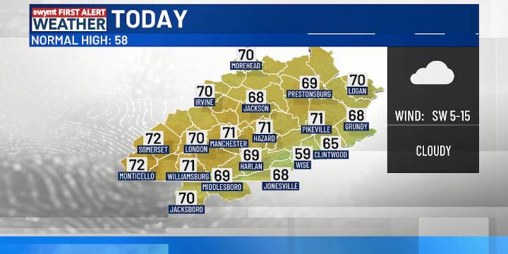
HAZARD, Ky. (WYMT) -It’s a mild and windy start to the weekend across the Commonwealth, with temperatures climbing into the upper 60s and middle 70s today.
Warm and breezy skies are a sign of some changes coming, with a cold front approaching. Mostly cloudy conditions with wind gusts 30+mph during the daytime pave the way for a brief round of light rain showers. Some isolated thunder can’t be ruled out as showers sweep through after sunset, and things remain very scattered and quick-moving.
By Sunday, skies clear behind the front, with a more seasonable breeze dropping afternoon highs into the upper 40s and mid-50s. Expect similar conditions on Monday: cool, dry air will persist, though clouds will start to thicken late in the day.
Widespread light to moderate rainfall is expected to ro

 Daily Voice
 NBC Connecticut
 Siskiyou Daily News
 FOX 11 California
 CBS Philly
 Denver7 News
 The Traverse City Record-Eagle
 Raw Story