
 WEVV 44News
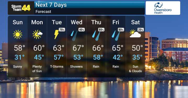
Well, it's certainly been a warm stretch, and we're keeping a close eye on the temperatures continuing to run well above seasonal averages for today. We’re expecting some gusty southwest winds to accompany this warmth, so it’ll feel quite breezy out there. However, a change is on the horizon. We will be monitoring a cold front as it makes its passage through our area tonight. This front is expected to usher in cooler, more seasonable air that should keep readings in check from Sunday into Monday.
Looking ahead, our forecast models indicate a warming trend will begin again late Monday night as a warm front lifts into our region. This will bring the chance for showers and even some thunderstorms late Monday into Tuesday morning. But the main event for widespread precipitation appears to be

 Daily Voice
 WREX
WREX 13 On Your Side
 Lehigh Valley Live
 Northern News Now
 Mediaite
 Newsweek Top
 Crooks and Liars
 Bozeman Daily Chronicle Sports
 Alliance Review