
 Denver7 News
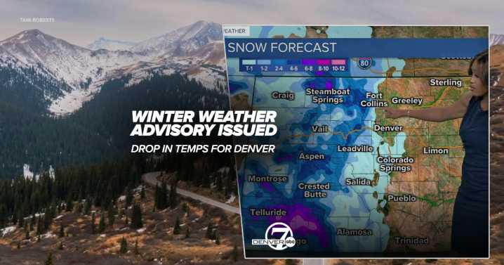
DENVER – While northeastern Colorado, including the Denver metro, will see another day of temperatures well above normal, a weather system will roll through the state starting Sunday bringing snow to the High Country and dropping temperatures for the week ahead for the Front Range.
Snow is expected to develop in the mountains starting Sunday evening with potential travel impacts in the Park Range and Rabbit Ears Pass where the National Weather Service (NWS) has issued a winter weather advisory starting at 8 p.m. Sunday.
The weather alert remains in effect until 5 p.m. Monday for the possibility of 3 to 8 inches of accumulations above 9,000 feet in West Jackson and West Grand Counties, said NWS forecasters.
Even higher accumulations are possible in elevations above 10,000 in these two c

 KDVR
KDVR KTAR News 92.3
 The Babylon Bee
 AlterNet
 CourierPress Sports
 cleveland.com
 The Takeout
 FOX 5 Atlanta Crime
 TODAY Video
 People Top Story