
 FOX 26 Harris County
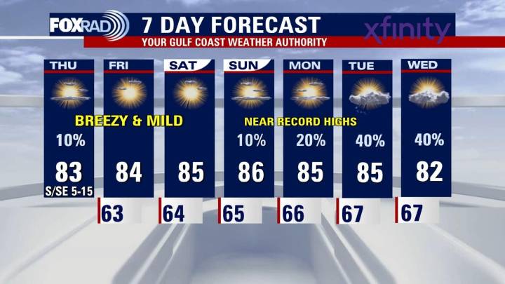
HOUSTON - Today will feature partly cloudy to mostly sunny skies with afternoon temperatures rising into the low to mid 80s
Warm into the weekend and beyond
The warm trend is expected to hold through the weekend and early next week thanks to a steady onshore breeze and a jet stream pattern that will keep cold air in the Northeastern US for now. Daily record highs are in jeopardy Sunday through Wednesday with records in the mid 80s and forecast highs also in the mid 80s.
Patchy morning fog possible
Overnight and into early mornings, particularly in low-lying and inland areas, there’s a chance for patchy fog formation as light winds and humid late-night air settles in. Once the sun is up, the fog will clear and each of the next several days will be very similar with lows in the 60s and

 ABC13
ABC13 FOX 26 Texas
 KRGV Rio Grande Valley
 The Conversation
 KENS 5
 FOX 5 Atlanta Crime
 FOX 4 News Arlington
 Click2Houston
 OK Magazine