
For very early Sunday evening, things should become less widespread as the first system moves out. However, don’t get too comfortable, because another, colder system is poised to move in late Sunday Evening into Monday. This next system brings renewed chances for more widespread rain and, importantly for our mountain communities, moderate snow. Snow levels will drop significantly with this one, potentially down to about 5500-6000 feet by Monday morning. This means we’re looking at snow accumulations of 4 to 10 inches above 6000 feet, with possibly higher amounts on the peaks. We’re also going to be watching for the potential of thunderstorms on Monday afternoon. Breezy southerly winds will continue with this colder air mass, possibly gusting between 25 to 35 mph. We will be monitoring ever
Unsettled at times through next week
 Action News Now11/16
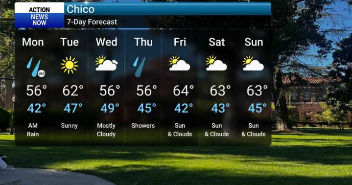
43

 AccuWeather Severe Weather
 WYMT
WYMT WIS News 10
 KRIS 6 News Weather
 CBS Los Angeles
 KTLA
KTLA The Advocate
 The Weather Channel
 The Babylon Bee
 The Daily Beast