
 WAFB
WAFB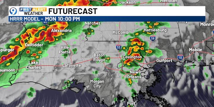
BATON ROUGE, La. (WAFB) - A stronger cold front is on the way, bringing a severe weather threat and another cool-down in time for Thanksgiving.
TODAY’S FORECAST
Another cooler start will give way to a warm afternoon, with highs in the low 80s. A few showers and storms are expected to develop by late afternoon and continue after dark as a weather system approaches from the west.
SEVERE STORM THREAT
As storms move into the state later today, there is an isolated threat for severe weather. A Level 1 of 5 (Marginal) risk clips the western edge of Pointe Coupee Parish, West Feliciana Parish, and Wilkinson and Amite counties in southern Mississippi.
By Tuesday morning and into early Wednesday, the severe threat expands eastward to include most of our viewing area, with the greatest risk exp

 America News
 Daily Voice
 WAND TV
 The Cut
 NFL News
 Spectrum Bay News 9
 NFL Seattle Seahawks