
 USA TODAY National
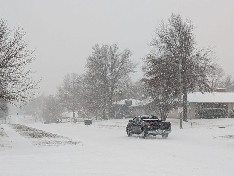
As much of the northern tier of the nation recovers from a series of recent winter storms, a potent system has begun blanketing the Northeast in heavy snow.
Since the start of the weekend, parts of the upper Plains and Great Lakes region saw over a foot of snowfall, including parts of Illinois, Iowa and Wisconsin, leading to road closures and hundreds of flight delays and cancellations.
Some cities, such as Chicago and Kansas City, experienced record-breaking snowfall amounts.
Now the Northeast is experiencing its first major snow storm of the winter season. Forecasters project 8 to 12 inches of snow could pile up across New York, Connecticut, Massachusetts and Maine through the midweek.
Tens of millions were under winter weather advisories on Dec. 2, from South Carolina and Ohio to New Hampshire and Maine, according to the National Weather Service.
How much snow has fallen? See map
What places have seen record snowfall?
Cross-country snowstorms that have pummeled the northern tier of the U.S. have broken daily snowfall records in Illinois and Missouri.
On Monday, Dec. 1, Kansas City International Airport recorded 3.6 inches of snow, smashing the previous daily snowfall record of 1.5 inches set in 1985.
Two days earlier, meteorologists recorded 8.4 inches of snow in Chicago, setting a new city record for the most snowfall observed on one calendar day in November. The previous record was set in 1951.
Low visibility, dangerous travel conditions across the Northeast
The low-pressure system tracking off the Mid-Atlantic coast prompted dozens of local weather advisories and warnings as it began unloading snow across the Northeast.
Forecasters said snowfall rates of over an inch per hour were likely, threatening low visibility for commuters and airport delays.
"Roads, and especially bridges and overpasses, will likely become slick and hazardous. Travel could be difficult to impossible," warned the National Weather Service office in Albany, New York.
Similar warnings have been issued throughout the Mid-Atlantic and New England.
Central, western US to see more snowstorms, forecasters say
After days of pounding snowfall, parts of the central U.S. could see more flurries over the coming days, the weather service said.
A winter storm system moving over the Rockies is expected to dump moderate to heavy mountain snow through the rest of the week, federal forecasters said.
At the same time, parts of Wisconsin, Idaho and Wyoming were under winter weather advisories as meteorologists projected over up to half a foot of snow in some areas.
(This story has been updated to add new information.)
Contributing: Doyle Rice
This article originally appeared on USA TODAY: How much snow has fallen? Track winter storms barreling across the US
Reporting by Christopher Cann, USA TODAY / USA TODAY
USA TODAY Network via Reuters Connect

 Local News in New Jersey
 Daily Voice
 WLWT
WLWT New York Post
 The Conversation
 KSLA News
 America News
 Cover Media