
 The Jersey Journal
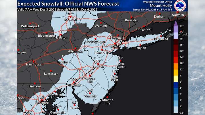
Some light snow is possible across much of New Jersey on Friday night after an Arctic blast of much frigid air could challenge record low temperatures.
Accumulations are expected to remain light, with no more than a coating possible, according to the National Weather Service. Any precipitation should end by Saturday afternoon.
For Wednesday, expect tranquil but cold conditions, with temperatures reaching the mid-30s to low 40s under mostly sunny skies.
Winds will gradually diminish through the afternoon as high pressure system settles over the region.
A strong cold front will sweep through New Jersey on Thursday afternoon, ushering in a brief but intense Arctic blast.
While the front itself is expected to pass through dry for most areas, isolated snow showers are possible across north

 Akron Beacon Journal
 Local News in New Jersey
 Daily Voice
 The radio station 99.5 The Apple
 KSNB Local4 Central Nebraska
 NBC 7 San Diego Local
 Associated Press US and World News Video
 The Oregonian Public Safety
 CNN Climate
 NECN Providence
 The Daily Beast