
 News Channel 36
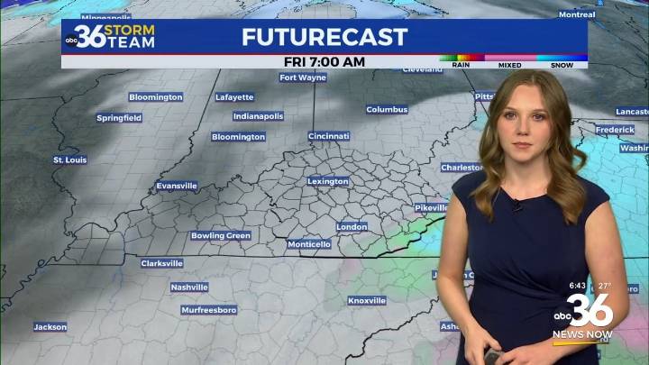
Thursday – Friday
A cold front moved through the Bluegrass overnight and brought in some frigid arctic air. Temperatures started in the upper 20s and will reach the low 30s for the afternoon. A light northern breeze will add even more chill to the air. As this front retreats to the east, it may bring a few flurries in during the afternoon. These will be inconsequential, causing no accumulation or impacts. Thursday night, a larger system passes to our south. It will bring snow showers to Southeastern KY.
The best chance for snow will be south of the Mountain Parkway. A few between the parkway and I-64 may see some flurries. To the south where the most snow is expected, accumulation will likely amount to trace amounts for most and up to 1 inch in isolated areas furthest south. This will li

 Spectrum News Louisville
 NEWS10 ABC
 Daily Voice
 KGNS
KGNS ABC News Weather
 WCNC Charlotte Weather
 KSNB Local4 Central Nebraska
 Sweetwater Now
 The Shaw Local News State
 NBC12
NBC12 KRIS 6 News Weather
 CNN
CNN