
 WWSB
WWSB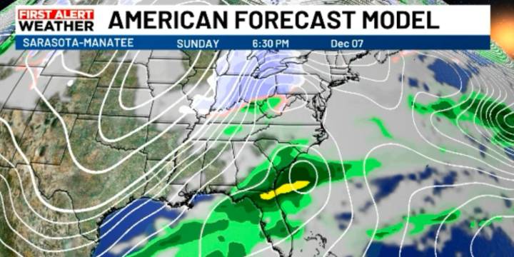
SARASOTA, Fla. (WWSB) - Today is shaping up to be another warm one, with highs reaching the low 80s under partly cloudy skies. A stalled boundary will form across the panhandle. As a result, clouds will continue increasing, and scattered showers become more likely as we move through Saturday and Sunday. Rain won’t be constant, but by the weekend a low, which forms on the stalled front will move across north Florida and enhance our rain fall chances Sunday. We can expect periods rain Sunday into Monday, and it will be a First Alert Weather Day which could linger into Monday.
Temperatures stay mild through the weekend, with highs in the 80s and lows mostly in the 60s. The thickening cloud cover will make things feel a bit more humid compared to earlier in the week.
Also, late Sunday into e

 CBS DFW
 1011 Now Lincoln
 KSNB Local4 Central Nebraska
 First Coast Crime
 People Crime
 WESH 2 News
 10 Tampa Bay
 News4JAX
 WCTV
WCTV The News Virginian Politics