
 WSIL-TV
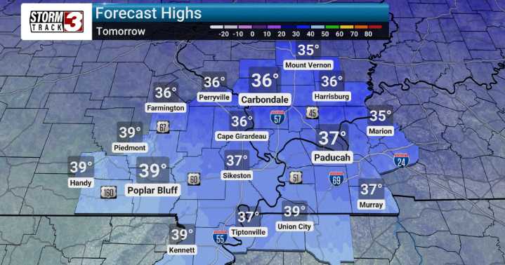
Sunday night there is a chance for some drizzle with a brief change over to some snow flurries possible as cooler air filters in, especially east of the Mississippi River. However, current forecasts indicate these amounts will be very light, and generally won't cause any travel concerns.
Looking ahead, Monday will usher in a brief cool-down, bringing highs back into the 30s. But don't get too comfortable, because another warm-up is on the way for Tuesday and Wednesday. This mid-week warm spell will bring breezy conditions ahead of a system that could introduce more widespread precipitation chances by Wednesday and into Thursday. We're specifically watching Wednesday into Thursday for a potential wintry mix across areas like Southwest Indiana, Northwest Kentucky, and parts of Southern Illi

 ABC News Weather
 Bring Me The News
 West Kentucky Star
 KOMU 8
 The Weather Channel
 KSNB Local4 Central Nebraska
 WWSB
WWSB WCNC Charlotte
 WISC-TV Channel 3000
 CBS Philly
 TIME
TIME