
 WKYT
WKYT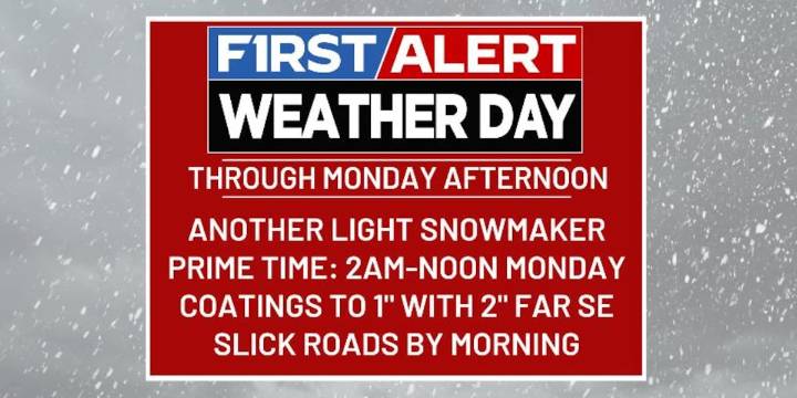
LEXINGTON, Ky. (WKYT) - It’s a WKYT First Alert Weather Day through Monday afternoon.
We have another light snow system pushing into the region tonight and early Monday. This system will likely bring some snow days and delays to areas of central and eastern Kentucky. All of this is ahead of a bigger push of harsh winter weather.
An arctic front drops in tonight with a wave of low pressure developing along it to our southeast. A few evening showers develop, but most of the moisture is behind the boundary and that means a decent area of light snow. This will spin through the east and southeast through Monday afternoon before departing.
Coatings to 1″ of snow will be possible for much of central and eastern Kentucky. The timing on this means a few delays and cancellations are possible Mond

 WHAS 11
 Newsweek Top
 West Kentucky Star
 WKYT Crime
 Essentiallysports College Sports
 Raw Story
 Associated Press US and World News Video
 Essentiallysports Golf
 The Conversation