
 Eyewitness News 3
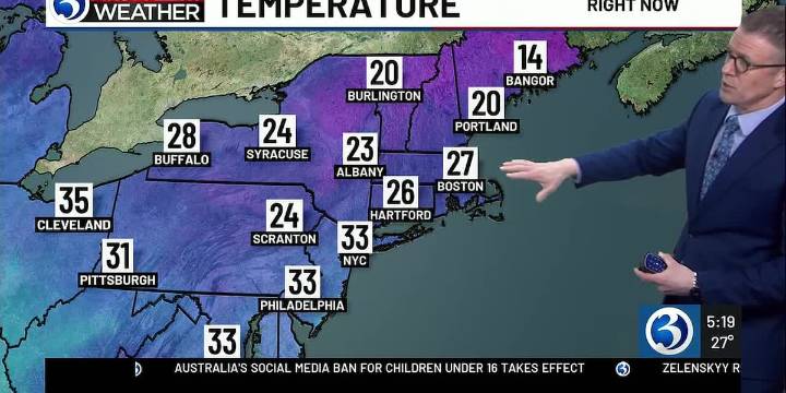
For any Alerts in effect for CT, click: here .
RECAP OF TODAY...
The Hartford Area record low of 4 set back in 1968 was missed by a degree this morning. Meanwhile, the record low of 10 in Bridgeport stands and the temp bottomed out at 16.
THIS EVENING, TONIGHT…
Temperatures initially in the 20s this evening will eventually trend up on a southwesterly wind, into the 30s as a warm front moves into and through the region. As this happens, some flurries will be possible. Otherwise, by daybreak expect temps near or above freezing for most of CT.
THE REST OF THE WEEK...
As a clipper moves into New England, we trend milder & unsettled... setting the stage for snow & rain showers tomorrow. Precipitation becomes likely from the afternoon into the evening hours. While this will be primarily

 Bring Me The News
 KSNB Local4 Central Nebraska
 West Kentucky Star
 WCNC Charlotte
 CBS Philly
 WWSB
WWSB KOMU 8
 KOLO8
KOLO8 Battle Creek Enquirer
 WNNY-TV
 AlterNet