
 Mirror
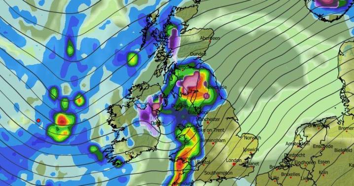
More snow looks to be heading to the UK as advanced modelling maps reveal a wintry weather front could soon hit Brits in several major cities across 24 hours
Several major cities could soon face snow as a 24-hour Arctic weather blast appears to be just days away from hitting the UK.
Advanced weather maps show snow falling in northern regions from around 6pm on December 18. At around 9pm, a weather front is tracked to sweep across the country from the Atlantic, bringing heavy rain to England and Wales , as well as snow to Northern Ireland .
By 3am on December 19, the maps show snow falling over the Pennines in northern England, as well as in the Highlands and parts of southern Scotland . More snow is then expected later on December 19. Maps for midday show intense flurries fa

 Birminghalm Mail
 Sunday Express
 The Daily Express
 Britain News
 America News
 Oh No They Didn't
 The Motley Fool
 The Fashion Spot
 Consequence Music
 Raw Story