
 KIMT News 3
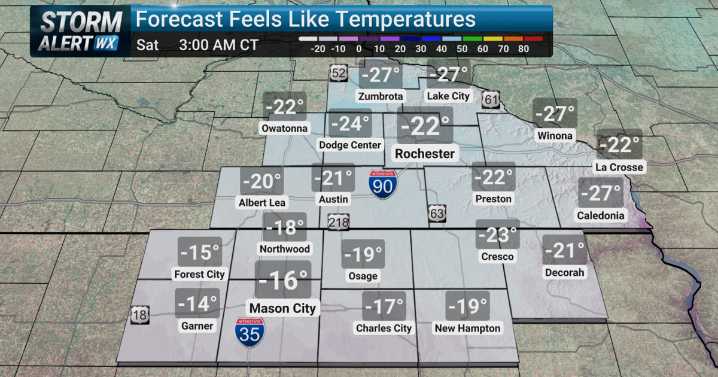
(KIMT) -- A potent cold front is slated to pass through SE Minnesota and North Iowa Friday morning, bringing back those whipping northwest winds. Winds are set to gust up to 30 MPH at times Friday afternoon, which will tumble our temperatures to the single digits by sundown.
Wind chills will plummet to dangerous levels behind this front as the new arctic air mass envelops the Upper Midwest. Saturday morning wind chills will drop to the -20s, meanwhile Sunday morning will be even lower. Wind chills are anticipated to fall to the -30s.
A Cold Weather Advisory will likely be issued ahead of this weekend's brutal cold. Make sure you are ready for this weekend's weather. Check in on your neighbors and friends to make sure they are ready as well. If you have to travel, have an emergency winter

 WOWT
WOWT The Gleaner
 KETV Omaha
 ABC News
 ABC News Weather
 KOLR10 News
 KNOE
KNOE WAND TV
 KGNS
KGNS NECN Providence
 The Gazette
 K2 Radio Local
 The Daily Beast