
 WMAR-2 News
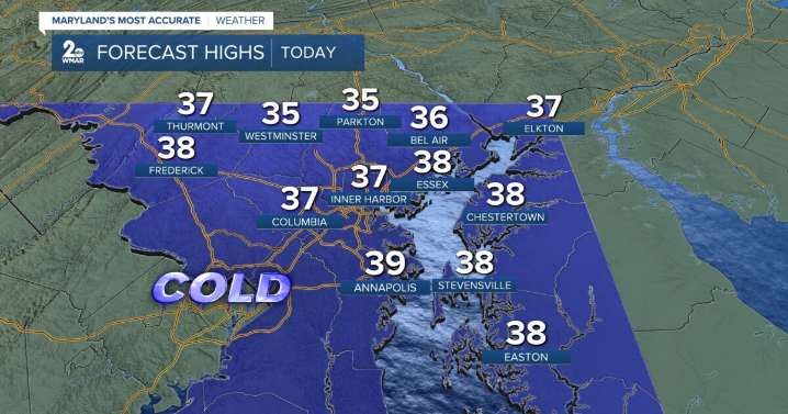
BALTIMORE — Happy Friday! A cold day with highs in the mid to upper-30s. Winds will be more relaxed. Don't be surprised if you see a few flurries today! All eyes are focused on the storm system that is expected to bring light accumulating snow to the area starting Saturday night and will linger into Sunday morning. As of right now, anywhere from 1-3" of snow is possible for the majority of the area, especially along I-95. If you're traveling either Saturday night or Sunday morning, drive carefully as some untreated roads could be slippery. Turning bitterly cold on Monday morning, thanks to blustery winds. Trending milder through the middle of next week!
Have a sunny day!
WMAR
Mostly sunny, with a high near 38. West wind 5-10 mph.
Increasing clouds, with a low around 25. Calm wind.
Par

 KWWL
KWWL WTOP
WTOP WBAL NewsRadio
 Daily Voice
 Verywell Health
 Raw Story
 Star Beacon
 The Atlantic