
 WVLT
WVLT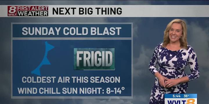
KNOXVILLE, Tenn. (WVLT) - After overnight elevation snow and even valley flurries, temperatures rebound briefly before tumbling into the weekend.
FRIDAY: Lingering snow showers mainly across Kentucky will gradually taper. Elsewhere, morning clouds will give way to afternoon sun. Highs will reach the low to mid 50s by the afternoon. Winds will be southwest at 10-15 mph. Lows will drop into 30s Friday night.
WEEKEND ARCTIC BLAST: It will be partly cloudy on Saturday with highs in the upper 40s to around 50. Lows will drop in the mid to upper 20s Saturday night with a few flurries or snow showers, mainly in the Smoky Mountains.
FIRST ALERT WEATHER DAY SUNDAY: Temperatures will fall into the low to mid 20s by afternoon behind a major Arctic cold front. Dangerously cold air takes hold

 Action News 5 Crime
 Citizen Tribune
 AlterNet
 Canadian Geographic Wildlife
 Akron Beacon Journal
 IMDb TV
 NBC News
 Raw Story