
 WREX
WREX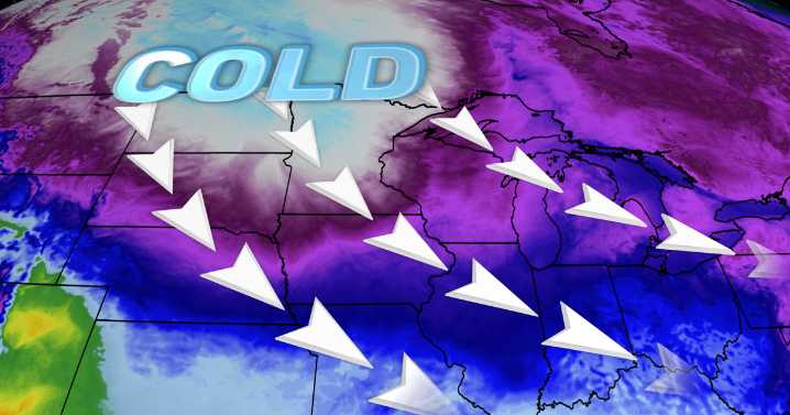
The most intense cold snap of the season so far is on the way for this weekend, setting up a period of dangerously cold temperatures.
First, one last clipper system is set to bring a swath of snow mainly to central Illinois on Saturday. On/off snow showers can be expected mainly for areas south of I-88 where some slick spots or snowy roads are possible. Elsewhere in northern Illinois, flurries can be anticipated with little impact. Chances for snow are mainly from 8 a.m. to 6 p.m.
The big story will be the dangerous cold snap across the Midwest. Cold Weather Advisories have been issued areawide with wind chills in the -20° to -30° range from 6 p.m. Saturday to Noon Sunday.
Wind chills will be entirely below 0° from Saturday morning to Monday morning, making it very important to bundle u

 ABC57 News
 Alabama News Network
 The Washington Post
 NECN Providence
 ABC6 Rhode Island
 NBC Connecticut
 Siskiyou Daily News
 The Oregonian Public Safety
 MyNorthwest
 WMTV NBC15
 IndyStarSports