
 cleveland.com
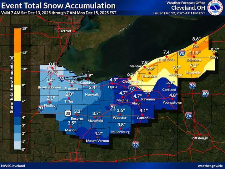
CLEVELAND, Ohio — As Northeast Ohio’s snowy and frigid weekend draws closer, some of the finer details are coming into focus, including an updated snow map released Friday afternoon by the National Weather Service in Cleveland.
The latest map reflects growing confidence in a two-part snow event , with a round of more widespread snow Saturday followed by persistent lake-effect snow Saturday night through Sunday, especially across parts of the snowbelt.
Where the highest totals are expected
The updated snow map aligns closely with a newly issued lake-effect snow warning , which is in effect from 1 p.m. Saturday through 7 a.m. Monday for Cuyahoga, Lake, Geauga and Ashtabula counties.
In those areas, forecasters expect 5 to 10 inches of snow, with the greatest accumulations favored acr

 Cleveland 19 News
 Cleveland Jewish News
 News 5 Cleveland
 The Scioto Post
 DoYouRemember?
 Atlanta Black Star Entertainment
 America News
 The Gaston Gazette Sports