
 KDKA
KDKA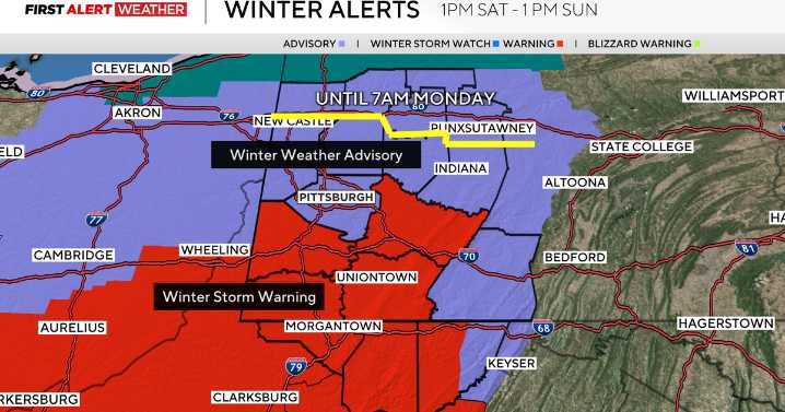
Snow moved in right on schedule, and we are now moving into the part of the event where the heaviest rates are expected.
Winds converging weakly in the mid-levels of the atmosphere will focus one or several narrow west-to-east-oriented heavy bands of snow generally near or just south of the Pittsburgh metro to I-70/I-68 corridors this evening through 11 p.m.
The steady, widespread snow will slowly taper from northwest to southeast between midnight through 4 a.m. Sunday with lingering flurries and snow showers. Lake-effect snow showers are expected to increase in coverage after sunrise and persist most of Sunday into Monday morning. Most of these will impact the I-80 to Route 422 corridors, but it is likely some of these bands—especially if we get a solid fetch off of Huron as well—will m

 WCBI-TV
 CBS Philly
 Arizona's Family
 WFMJ-TV
 KIMT News 3
 Delaware County Daily Times
 Times West Virginian
 KXLH
KXLH The Washington Post
 WNDU
WNDU NBC Chicago Entertainment