
 WKYT
WKYT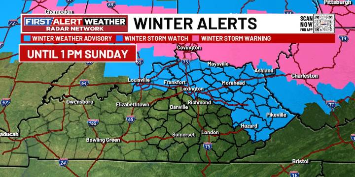
LEXINGTON, Ky. (WKYT) - Our FIRST ALERT WEATHER DAYS continue through Monday as more winter weather and bitter cold take hold of the region.
Scattered snow showers arrive in the region this evening and last only into the early overnight. Up to 2 inches of new snow is expected along the I-64 corridor, the Mountain Parkway, and into eastern Kentucky, with higher totals to the north and lower totals to the south. It will turn bitterly cold as we see lows in the upper single digits to low teens. Wind chills will dip as low as 0 to 10 degrees below zero.
Partly cloudy skies are expected for Sunday as it will be an absolutely frigid day. Highs will only be in the mid to upper teens with wind chills remaining in the single digits. Another bitterly cold night for Sunday night with lows of 0 to

 WKOW 27
 WSAZ NewsChannel 3
 WMTV NBC15
 Times West Virginian
 WAVE 3 News
 Crooks and Liars
 The Daily Beast
 AlterNet
 Tom's Guide
 DoYouRemember?
 The Rink Live