
 FOX Weather
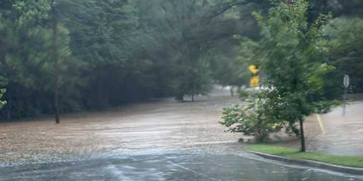
SAVANNAH, Ga. – A stalled frontal boundary draped across the Southeast , combined with developing areas of low pressure, is setting the stage for several more days of heavy rainfall from the Interstate 10 corridor northward through Georgia and the Carolinas.
According to the FOX Forecast Center, the potential for daily rounds of rain and thunderstorms will persist through the weekend, with some areas could receive double-digit rainfall totals.
Flood Watches remain in effect for multiple counties across the region, particularly in areas that have already experienced significant rainfall over the past week.
These watches can be upgraded to Flood Warnings if storms repeatedly pass over the same locations, swamping already saturated ground and overwhelming drainage systems.
Cities and comm

 America News
 KXLH
KXLH KSNB Local4 Central Nebraska
 KCRA News
 Detroit News
 Lansing State Journal
 Sweetwater Now
 Raw Story
 CNN Crime and Justice