
 FOX Weather
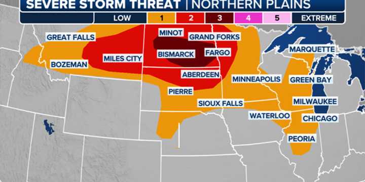
BISMARCK, N.D. – A frontal boundary slowly pushing through the northern tier of the country will be the focus of severe thunderstorms over the next couple of days, with thunderstorms capable of producing tornadoes, damaging wind gusts and hail.
NOAA’s Storm Prediction Center has placed parts of North Dakota , including Bismarck and Fargo, under the greatest risk for severe storms on Thursday, with the threat shifting slightly eastward on Friday.
The most intense storm activity is forecast to develop during the late afternoon and evening hours, with thunderstorms potentially continuing into the overnight period.
Forecasters warn that some of these storms could evolve into a mesoscale convective system (MCS) , which could take the form of a squall line or even a derecho , depending on the

 America News
 KXLH
KXLH KSNB Local4 Central Nebraska
 KCRA News
 Detroit News
 Lansing State Journal
 Sweetwater Now
 New York Post Opinion