
 WMTV NBC15
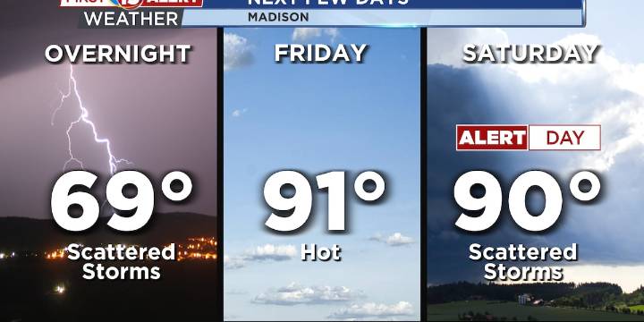
Iso showers and storms tonight
Near 100F heat index Friday & Saturday
Strong storms expected Saturday
MADISON, Wis. (WMTV) - This evening, Southern Wisconsin is looking at isolated showers and thunderstorms. Most of this activity will be hit or miss, but the storms could bring locally heavy rain, gusty winds, and hail. There’s some dry air aloft that could trigger microbursts in the strongest cells, so isolated damaging winds are possible. The timing will be mainly through the afternoon into early evening before things start to wind down.
Friday shifts gears as a warm, humid air mass moves in. High pressure will retreat east, and southerly winds will push temperatures into the upper 80s and low 90s, with heat indices climbing into the upper 90s. Click Here for Interactive Radar
What

 NBC26
NBC26 WKOW 27
 Daily Kos
 America News
 TMZ
TMZ Associated Press US News
 HealthDay
 The radio station 99.5 The Apple
 KETV Sports