
 21Alive News
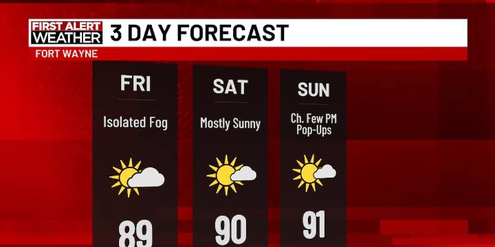
FORT WAYNE, Ind. (WPTA) - Hopefully your weekend plans involve a lake or pool... or even a hose! It’s going to be a hot, summery weekend with the heat index peaking in the mid 90s.
Some isolated fog continues to develop this morning, mainly in rural areas. Similar to yesterday, I expect this to gradually mix out between 7 and 8 am. It will be humid throughout the day (and the next several days). Highs today will push into the upper 80s with partly to mostly sunny skies.
Weak chances for pop-up showers exist for Sunday and early next week. Rain and storm chances kick in a bit more by Tuesday and Wednesday as our next front arrives.
A very hot pattern looks to kick in shortly after our 7-day forecast period. Extended trends into next weekend push well above average for this time of year,

 The Journal Gazette
 WTHR
WTHR IndyStar
 Newsday
 NewsTalk 1280
 FOX 8 News
 CBS4 Indy
 WEVV 44News Crime
 WNDU
WNDU ABC News