
 Orlando Sentinel
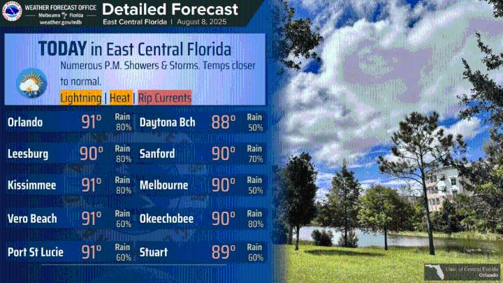
Afternoon and evening showers are forecast for Central Florida on Friday.
Frequent lightning strikes, wind gusts and heavy downpours that could lead to minor flooding are possible, according to NWS Melbourne.
Highs are in the low-90s across Central Florida, with peak heat indices up to 105 degrees.
There is a high risk of dangerous rip currents at all area beaches.
A preview of the weekend sees scattered to numerous showers ranging from 50 percent to 80 percent.
The heaviest amounts are expected to be in the interior, according to NWS Melbourne.
The timing of the highest coverage along the coast is the overnight and morning hours.
For the interior, it’s the afternoon and early evening. Originally Published: August 8, 2025 at 6:49 AM EDT

 America News
 KXLH
KXLH KSNB Local4 Central Nebraska
 KCRA News
 Detroit News
 Lansing State Journal
 Sweetwater Now
 AlterNet